
Thank you for supporting this site ❤️
Make a donation
Make a donation
Bunker topographic map
Click on the map to display elevation.
Thank you for supporting this site ❤️
Make a donation
Make a donation
About this map
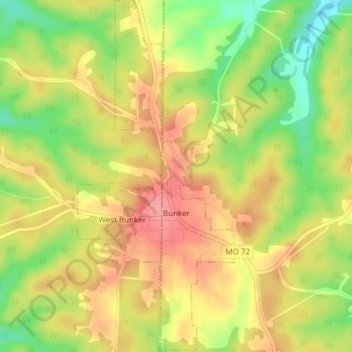
Name: Bunker topographic map, elevation, terrain.
Location: Bunker, Reynolds County, Missouri, 63629, United States (37.44378 -91.22027 37.47383 -91.20331)
Average elevation: 395 m
Minimum elevation: 344 m
Maximum elevation: 433 m
Thank you for supporting this site ❤️
Make a donation
Make a donation
Other topographic maps
Click on a map to view its topography, its elevation and its terrain.