
Chantilly topographic map
Interactive map
Click on the map to display elevation.
About this map
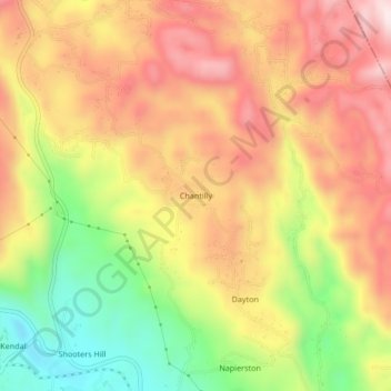
Name: Chantilly topographic map, elevation, terrain.
Location: Chantilly, Manchester, Middlesex County, Jamaica (18.08413 -77.48486 18.12413 -77.44486)
Average elevation: 627 m
Minimum elevation: 351 m
Maximum elevation: 851 m