
Thank you for supporting this site ❤️
Make a donation
Make a donation
Dahl topographic map
Click on the map to display elevation.
Thank you for supporting this site ❤️
Make a donation
Make a donation
Dahl
Kultureller Höhepunkt von Dahl-Friedrichsthal ist das Schützenfest zu Pfingsten.
Thank you for supporting this site ❤️
Make a donation
Make a donation
About this map
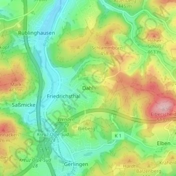
Name: Dahl topographic map, elevation, terrain.
Location: Dahl, Olpe, Kreis Olpe, Nordrhein-Westfalen, 57462, Deutschland (50.98223 7.83166 51.02223 7.87166)
Average elevation: 390 m
Minimum elevation: 314 m
Maximum elevation: 516 m
Thank you for supporting this site ❤️
Make a donation
Make a donation
Other topographic maps
Click on a map to view its topography, its elevation and its terrain.