
Thank you for supporting this site ❤️
Make a donation
Make a donation
Castiglione delle Stiviere topographic map
Click on the map to display elevation.
Thank you for supporting this site ❤️
Make a donation
Make a donation
About this map
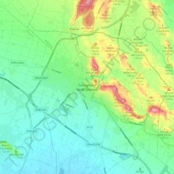
Name: Castiglione delle Stiviere topographic map, elevation, terrain.
Location: Castiglione delle Stiviere, Mantua, Lombardy, 46043, Italy (45.34968 10.44887 45.42968 10.52887)
Average elevation: 107 m
Minimum elevation: 67 m
Maximum elevation: 197 m
Thank you for supporting this site ❤️
Make a donation
Make a donation