
Thank you for supporting this site ❤️
Make a donation
Make a donation
Signal d'Ecouves topographic map
Click on the map to display elevation.
Thank you for supporting this site ❤️
Make a donation
Make a donation
About this map
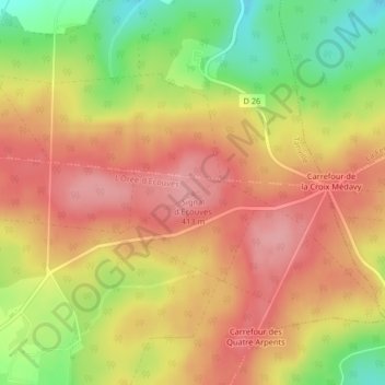
Name: Signal d'Ecouves topographic map, elevation, terrain.
Average elevation: 365 m
Minimum elevation: 294 m
Maximum elevation: 412 m
Thank you for supporting this site ❤️
Make a donation
Make a donation
Other topographic maps
Click on a map to view its topography, its elevation and its terrain.
Fontenai-les-Louvets
France > Normandie > Orne > L'Orée-d'Écouves
La commune est traversée par le méridien de Greenwich qui passe notamment par la nef de son église Notre-Dame. Le territoire de la commune est en grande partie situé dans la forêt d'Écouves. Le signal d'Écouves, avec une altitude de 413 mètres, est le point culminant de la région Basse-Normandie.
Average elevation: 340 m