
Thank you for supporting this site ❤️
Make a donation
Make a donation
Trysil topographic map
Click on the map to display elevation.
Thank you for supporting this site ❤️
Make a donation
Make a donation
About this map
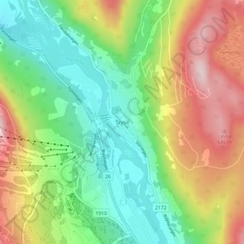
Name: Trysil topographic map, elevation, terrain.
Location: Trysil, Иннландет, Норвегия (61.29515 12.24386 61.33515 12.28386)
Average elevation: 470 m
Minimum elevation: 339 m
Maximum elevation: 673 m
Thank you for supporting this site ❤️
Make a donation
Make a donation
Other topographic maps
Click on a map to view its topography, its elevation and its terrain.
Thank you for supporting this site ❤️
Make a donation
Make a donation