
Bad Goisern topographic map
Interactive map
Click on the map to display elevation.
About this map
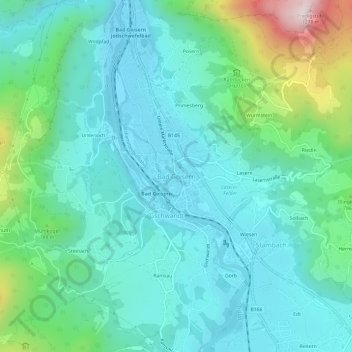
Name: Bad Goisern topographic map, elevation, terrain.
Average elevation: 644 m
Minimum elevation: 482 m
Maximum elevation: 1,256 m
Other topographic maps
Click on a map to view its topography, its elevation and its terrain.
Stambach
Österreich > Bezirk Gmunden > Bad Goisern am Hallstättersee
Stambach, Bad Goisern am Hallstättersee, Bezirk Gmunden, 4822, Österreich
Average elevation: 624 m