
Thank you for supporting this site ❤️
Make a donation
Make a donation
Bisenti topographic map
Click on the map to display elevation.
Thank you for supporting this site ❤️
Make a donation
Make a donation
About this map
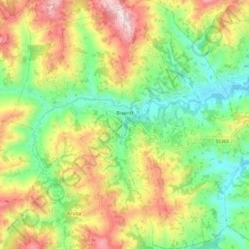
Name: Bisenti topographic map, elevation, terrain.
Location: Bisenti, Teramo, Abruzzo, 64033, Italy (42.49268 13.75795 42.55939 13.84419)
Average elevation: 408 m
Minimum elevation: 204 m
Maximum elevation: 691 m
Thank you for supporting this site ❤️
Make a donation
Make a donation
Other topographic maps
Click on a map to view its topography, its elevation and its terrain.
La cerqua di Roncacé (quercia secolare)
Italy > Abruzzo > Teramo > Controguerra > San Giovanni II
Average elevation: 197 m
Thank you for supporting this site ❤️
Make a donation
Make a donation
Thank you for supporting this site ❤️
Make a donation
Make a donation