
Laxe topographic map
Interactive map
Click on the map to display elevation.
About this map
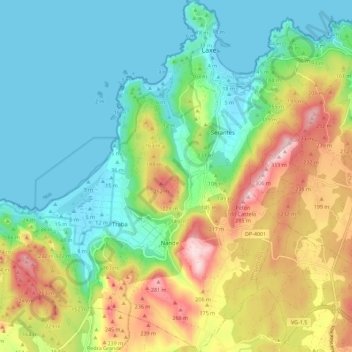
Name: Laxe topographic map, elevation, terrain.
Location: Laxe, Bergantiños, A Coruña, Galicië, Spanje (43.15116 -9.07804 43.23345 -8.97202)
Average elevation: 104 m
Minimum elevation: -1 m
Maximum elevation: 307 m