
Canaan topographic map
Interactive map
Click on the map to display elevation.
About this map
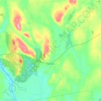
Name: Canaan topographic map, elevation, terrain.
Location: Canaan, Somerset County, Maine, 04924, États-Unis d'Amérique (44.70463 -69.60747 44.85920 -69.47665)
Average elevation: 100 m
Minimum elevation: 30 m
Maximum elevation: 260 m
Other topographic maps
Click on a map to view its topography, its elevation and its terrain.
St. Zacharie
États-Unis d'Amérique > Maine > Somerset County > T5 R20 WELS
St. Zacharie, T5 R20 WELS, Somerset County, Maine, États-Unis d'Amérique
Average elevation: 540 m
Saint Aurelie
États-Unis d'Amérique > Maine > Somerset County
Saint Aurelie, Big Six Township, Somerset County, Maine, 04478, États-Unis d'Amérique
Average elevation: 424 m