
Thank you for supporting this site ❤️
Make a donation
Make a donation
Liederbach topographic map
Click on the map to display elevation.
Thank you for supporting this site ❤️
Make a donation
Make a donation
Liederbach
Die Statistisch-topographisch-historische Beschreibung des Großherzogthums Hessen berichtet 1830 über Liederbach.
Thank you for supporting this site ❤️
Make a donation
Make a donation
About this map
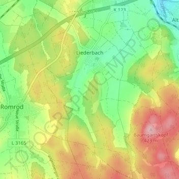
Name: Liederbach topographic map, elevation, terrain.
Location: Liederbach, Alsfeld, Vogelsbergkreis, Hessen, Deutschland (50.69798 9.22661 50.73893 9.26584)
Average elevation: 333 m
Minimum elevation: 260 m
Maximum elevation: 424 m
Thank you for supporting this site ❤️
Make a donation
Make a donation
Other topographic maps
Click on a map to view its topography, its elevation and its terrain.