
Thank you for supporting this site ❤️
Make a donation
Make a donation
Sidi Dhrif topographic map
Click on the map to display elevation.
Thank you for supporting this site ❤️
Make a donation
Make a donation
About this map
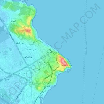
Name: Sidi Dhrif topographic map, elevation, terrain.
Location: Sidi Dhrif, Gouvernorat Tunis, 1054, Tunisie (36.84100 10.29568 36.92100 10.37568)
Average elevation: 8 m
Minimum elevation: -4 m
Maximum elevation: 123 m
Thank you for supporting this site ❤️
Make a donation
Make a donation
Other topographic maps
Click on a map to view its topography, its elevation and its terrain.