
Make a donation
Huambo Province topographic map
Click on the map to display elevation.
Make a donation
Huambo Province
The Central Plateau is well within the tropical zone, but altitude and the effect of the southwestern Antarctic current combine to produce a moderate climate. The annual variation of temperature is small, with maximum temperatures varying between 17 and 28 °C during much of the year. The average maximum is approximately 22 °C. During the winter months (May–July), temperatures may reach as low as 5 to 8 °C. Mean annual rainfall varies from 800 to 1600 mm, according to region. In the Central Plateau, seasonal rains begin with a few showers during September, increase during October and November, have a break of two to four weeks in December, January or February, and continue until the end of April. The heaviest rainfall is usually in November or December.
Make a donation
About this map
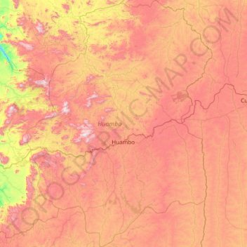
Name: Huambo Province topographic map, elevation, terrain.
Location: Huambo Province, Angola (-13.76667 14.79259 -11.43389 16.59743)
Average elevation: 1,601 m
Minimum elevation: 855 m
Maximum elevation: 2,546 m
Make a donation
Other topographic maps
Click on a map to view its topography, its elevation and its terrain.