
Galisteo topographic map
Interactive map
Click on the map to display elevation.
About this map
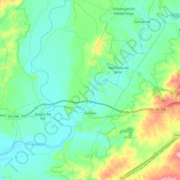
Name: Galisteo topographic map, elevation, terrain.
Average elevation: 297 m
Minimum elevation: 235 m
Maximum elevation: 503 m
Other topographic maps
Click on a map to view its topography, its elevation and its terrain.
Carcaboso
Espanha > Estremadura > Vegas del Alagón
Carcaboso, Vegas del Alagón, Cáceres, Estremadura, 10670, Espanha
Average elevation: 279 m