
Heringen (Werra) topographic map
Interactive map
Click on the map to display elevation.
About this map
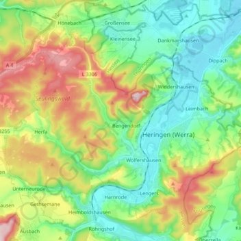
Name: Heringen (Werra) topographic map, elevation, terrain.
Average elevation: 309 m
Minimum elevation: 208 m
Maximum elevation: 508 m
Other topographic maps
Click on a map to view its topography, its elevation and its terrain.
Kirchheim
Deutschland > Hessen > Landkreis Hersfeld-Rotenburg
Kirchheim, Landkreis Hersfeld-Rotenburg, Hessen, 36275, Deutschland
Average elevation: 309 m
Hönebach
Deutschland > Hessen > Landkreis Hersfeld-Rotenburg
Hönebach, Wildeck, Landkreis Hersfeld-Rotenburg, Hessen, Deutschland
Average elevation: 353 m