
Thank you for supporting this site ❤️
Make a donation
Make a donation
Eagle Harbor Township topographic map
Click on the map to display elevation.
Thank you for supporting this site ❤️
Make a donation
Make a donation
About this map
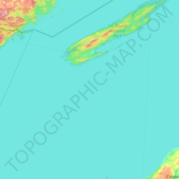
Name: Eagle Harbor Township topographic map, elevation, terrain.
Average elevation: 190 m
Minimum elevation: 176 m
Maximum elevation: 564 m
Thank you for supporting this site ❤️
Make a donation
Make a donation
Other topographic maps
Click on a map to view its topography, its elevation and its terrain.
Thank you for supporting this site ❤️
Make a donation
Make a donation
Montreal River
United States > Michigan > Keweenaw County > Nepco Camp Number 7
Average elevation: 345 m