
Thank you for supporting this site ❤️
Make a donation
Make a donation
Elbow topographic map
Click on the map to display elevation.
Thank you for supporting this site ❤️
Make a donation
Make a donation
Elbow
The elevation is 2,549 feet (777 m).
Thank you for supporting this site ❤️
Make a donation
Make a donation
About this map
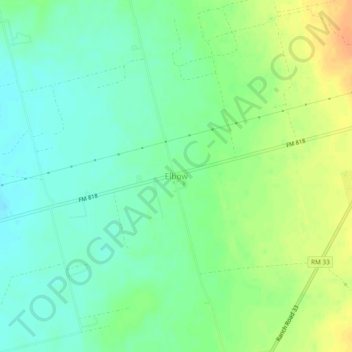
Name: Elbow topographic map, elevation, terrain.
Location: Elbow, Howard County, Texas, United States (32.14040 -101.53207 32.18040 -101.49207)
Average elevation: 779 m
Minimum elevation: 764 m
Maximum elevation: 801 m
Thank you for supporting this site ❤️
Make a donation
Make a donation
Other topographic maps
Click on a map to view its topography, its elevation and its terrain.