
Ryńskie topographic map
Interactive map
Click on the map to display elevation.
About this map
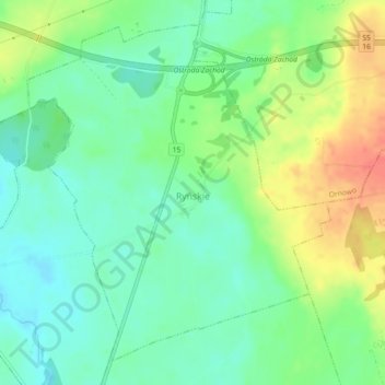
Name: Ryńskie topographic map, elevation, terrain.
Average elevation: 141 m
Minimum elevation: 121 m
Maximum elevation: 175 m
Other topographic maps
Click on a map to view its topography, its elevation and its terrain.
Ostróda
Poland > Warmian-Masurian Voivodeship > Ostróda County > Ostróda
Ostróda, Ostróda County, Warmian-Masurian Voivodeship, Poland
Average elevation: 106 m
Szymanowo
Poland > Warmian-Masurian Voivodeship > Ostróda County > Nowy Dwór
Szymanowo, Nowy Dwór, gmina Morąg, Ostróda County, Warmian-Masurian Voivodeship, 14-300, Poland
Average elevation: 125 m
Dylewska Góra
Poland > Warmian-Masurian Voivodeship > Ostróda County > Wysoka Wieś
Dylewska Góra, Wysoka Wieś, gmina Ostróda, Ostróda County, Warmian-Masurian Voivodeship, Poland
Average elevation: 269 m