
Santa Cruz del Quiché topographic map
Interactive map
Click on the map to display elevation.
About this map
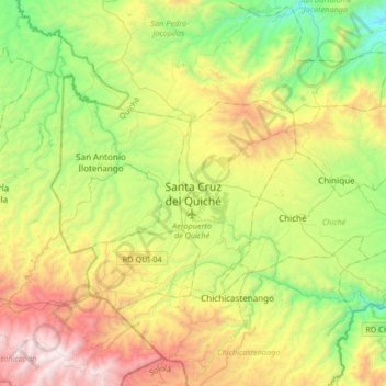
Name: Santa Cruz del Quiché topographic map, elevation, terrain.
Location: Santa Cruz del Quiché, Quiche, 14001, Guatemala (14.86951 -91.30962 15.18951 -90.98962)
Average elevation: 2,090 m
Minimum elevation: 1,312 m
Maximum elevation: 3,369 m