
Thank you for supporting this site ❤️
Make a donation
Make a donation
Murten topographic map
Click on the map to display elevation.
Thank you for supporting this site ❤️
Make a donation
Make a donation
About this map
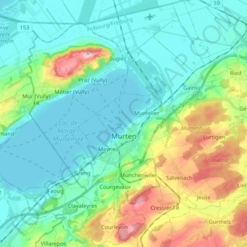
Name: Murten topographic map, elevation, terrain.
Location: Murten, See District, Fribourg, Switzerland (46.88224 7.08265 46.98633 7.21044)
Average elevation: 480 m
Minimum elevation: 423 m
Maximum elevation: 652 m
Thank you for supporting this site ❤️
Make a donation
Make a donation