
Thank you for supporting this site ❤️
Make a donation
Make a donation
Silbersattel topographic map
Click on the map to display elevation.
Thank you for supporting this site ❤️
Make a donation
Make a donation
About this map
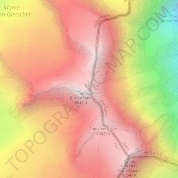
Name: Silbersattel topographic map, elevation, terrain.
Location: Silbersattel, Zermatt, Visp, Wallis, 3920, Schweiz (45.93748 7.86833 45.93758 7.86843)
Average elevation: 4,009 m
Minimum elevation: 2,918 m
Maximum elevation: 4,619 m
Thank you for supporting this site ❤️
Make a donation
Make a donation
Other topographic maps
Click on a map to view its topography, its elevation and its terrain.
Mattertal
Schweiz > Wallis > Visp > Zermatt
Der tiefste Punkt des Mattertals liegt auf 723,5 m ü. M. am unteren Ende des Tals bei Stalden. Mehrere Gipfel der Berge, die das Tal von drei Seiten umschliessen, erheben sich auf über 4500 m. Davon sind der Dom im Osten und das Weisshorn im Westen die einzigen, die nicht auf dem Alpenhauptkamm liegen. Der…
Average elevation: 2,369 m