
Thank you for supporting this site ❤️
Make a donation
Make a donation
Twin Peak topographic map
Click on the map to display elevation.
Thank you for supporting this site ❤️
Make a donation
Make a donation
About this map
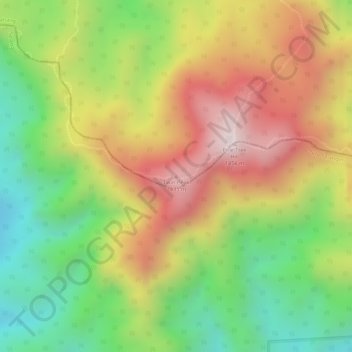
Name: Twin Peak topographic map, elevation, terrain.
Location: Twin Peak, Raub, Pahang, Malásia (3.70797 101.69212 3.70807 101.69222)
Average elevation: 1,143 m
Minimum elevation: 855 m
Maximum elevation: 1,429 m
Thank you for supporting this site ❤️
Make a donation
Make a donation
Other topographic maps
Click on a map to view its topography, its elevation and its terrain.