
Thank you for supporting this site ❤️
Make a donation
Make a donation
Mundwa topographic map
Click on the map to display elevation.
Thank you for supporting this site ❤️
Make a donation
Make a donation
Mundwa
Mundwa is located at 27°04′N 73°49′E / 27.07°N 73.82°E / 27.07; 73.82. It has an average elevation of 335 metres (1099 feet). There are four Talabs on all the four directions of Mundwa. Names of these Talabs are
Thank you for supporting this site ❤️
Make a donation
Make a donation
About this map
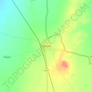
Name: Mundwa topographic map, elevation, terrain.
Location: Mundwa, Mundwa Tehsil, Nagaur, Rajasthan, India (27.02281 73.78170 27.10281 73.86170)
Average elevation: 332 m
Minimum elevation: 304 m
Maximum elevation: 377 m
Thank you for supporting this site ❤️
Make a donation
Make a donation