
Niederau topographic map
Interactive map
Click on the map to display elevation.
About this map
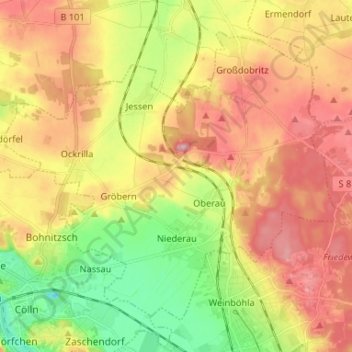
Name: Niederau topographic map, elevation, terrain.
Location: Niederau, Meißen, Saksen, Duitsland (51.15768 13.47857 51.22532 13.61001)
Average elevation: 154 m
Minimum elevation: 85 m
Maximum elevation: 218 m
Other topographic maps
Click on a map to view its topography, its elevation and its terrain.