
Wahlhausen topographic map
Interactive map
Click on the map to display elevation.
About this map
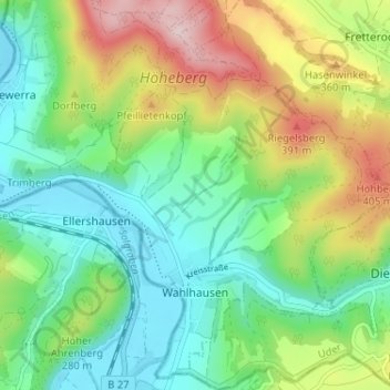
Name: Wahlhausen topographic map, elevation, terrain.
Average elevation: 253 m
Minimum elevation: 140 m
Maximum elevation: 473 m
Other topographic maps
Click on a map to view its topography, its elevation and its terrain.
Rohrberg
Duitsland > Thüringen > Landkreis Eichsfeld
Rohrberg, Hanstein-Rusteberg, Landkreis Eichsfeld, Thüringen, Duitsland
Average elevation: 320 m
Klusberg
Duitsland > Thüringen > Landkreis Eichsfeld > Großbartloff
Klusberg, Großbartloff, Westerwald-Obereichsfeld, Landkreis Eichsfeld, Thüringen, Duitsland
Average elevation: 372 m