
Piz Lagrev topographic map
Interactive map
Click on the map to display elevation.
About this map
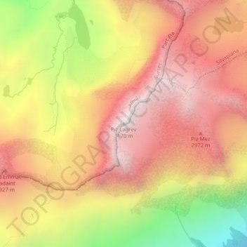
Name: Piz Lagrev topographic map, elevation, terrain.
Location: Piz Lagrev, Surses, Albula, Grigioni, 7515, Svizzera (46.44578 9.72273 46.44588 9.72283)
Average elevation: 2,624 m
Minimum elevation: 1,846 m
Maximum elevation: 3,133 m
Other topographic maps
Click on a map to view its topography, its elevation and its terrain.
Piz Platta
Piz Platta, Surses, Albula, Grigioni, 7448, Svizzera
Average elevation: 2,663 m