
Thank you for supporting this site ❤️
Make a donation
Make a donation
Eystfelli topographic map
Click on the map to display elevation.
Thank you for supporting this site ❤️
Make a donation
Make a donation
About this map
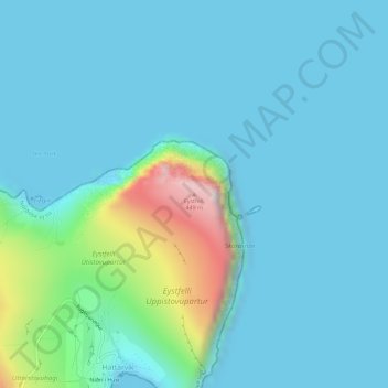
Name: Eystfelli topographic map, elevation, terrain.
Location: Eystfelli, Hattarvík, Norðoya sýsla, 767, Færøerne (62.34149 -6.26362 62.34159 -6.26352)
Average elevation: 68 m
Minimum elevation: -6 m
Maximum elevation: 466 m
Thank you for supporting this site ❤️
Make a donation
Make a donation