
Make a donation
Hotel Jugoslavija topographic map
Click on the map to display elevation.
Make a donation
Hotel Jugoslavija
The station was operational until 1970. To commemorate it, architect Milun Stambolić designed a memorial complex which consists of 5 pillars, which used to hold the station's overhang, and several meters of railroad tracks. The complex is placed on the plateau next to the hotel, on the small elevation above the promenade along the Danube. The memorial complex was set in the 1980s.
Make a donation
About this map
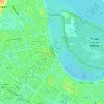
Name: Hotel Jugoslavija topographic map, elevation, terrain.
Average elevation: 77 m
Minimum elevation: 67 m
Maximum elevation: 101 m
Make a donation
Other topographic maps
Click on a map to view its topography, its elevation and its terrain.
Palilula Urban Municipality
Serbia > Central Serbia > City of Belgrade > Belgrade
Average elevation: 82 m
Make a donation
Banovo Brdo
Serbia > Central Serbia > City of Belgrade > Belgrade
New building of the Faculty of forestry was built in 1956, right above Careva Ćuprija, where the northwest section of the vast wood of Košutnjak begins at an altitude of 110-125 meters. Professors and students began developing a dendrology collection in 1957, which grew into the Arboretum of the Faculty of…
Average elevation: 99 m
Make a donation
Make a donation