
Thank you for supporting this site ❤️
Make a donation
Make a donation
Laney topographic map
Click on the map to display elevation.
Thank you for supporting this site ❤️
Make a donation
Make a donation
About this map
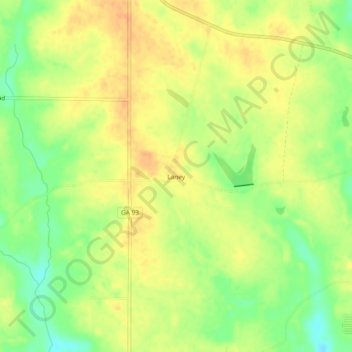
Name: Laney topographic map, elevation, terrain.
Location: Laney, Mitchell County, Georgia, 31784, United States (31.18852 -84.04657 31.22852 -84.00657)
Average elevation: 101 m
Minimum elevation: 79 m
Maximum elevation: 114 m
Thank you for supporting this site ❤️
Make a donation
Make a donation
Other topographic maps
Click on a map to view its topography, its elevation and its terrain.