
Thank you for supporting this site ❤️
Make a donation
Make a donation
Tinurik topographic map
Click on the map to display elevation.
Thank you for supporting this site ❤️
Make a donation
Make a donation
About this map
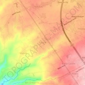
Name: Tinurik topographic map, elevation, terrain.
Location: Tinurik, Tanauan, Batangas, Calabarzon, 4232, Philippines (14.04393 121.10197 14.08393 121.14197)
Average elevation: 143 m
Minimum elevation: 20 m
Maximum elevation: 202 m
Thank you for supporting this site ❤️
Make a donation
Make a donation
Other topographic maps
Click on a map to view its topography, its elevation and its terrain.