
Make a donation
Scottish Highlands topographic map
Click on the map to display elevation.
Make a donation
Scottish Highlands
The entire region was covered by ice sheets during the Pleistocene ice ages, save perhaps for a few nunataks. The complex geomorphology includes incised valleys and lochs carved by the action of mountain streams and ice, and a topography of irregularly distributed mountains whose summits have similar heights above sea-level, but whose bases depend upon the amount of denudation to which the plateau has been subjected in various places.
Make a donation
About this map
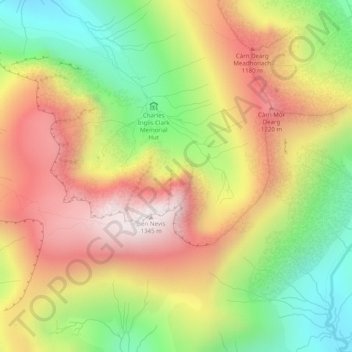
Name: Scottish Highlands topographic map, elevation, terrain.
Location: Scottish Highlands, Highland, Scotland, United Kingdom (56.79995 -5.00005 56.80005 -4.99995)
Average elevation: 907 m
Minimum elevation: 470 m
Maximum elevation: 1,338 m
Make a donation
Other topographic maps
Click on a map to view its topography, its elevation and its terrain.