
Ouaddaï topographic map
Interactive map
Click on the map to display elevation.
About this map
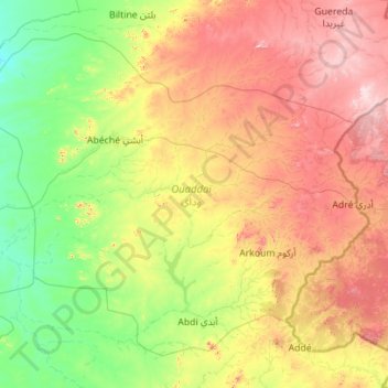
Name: Ouaddaï topographic map, elevation, terrain.
Location: Ouaddaï, Chad (12.61313 20.05600 14.41663 22.29141)
Average elevation: 656 m
Minimum elevation: 404 m
Maximum elevation: 1,272 m
Other topographic maps
Click on a map to view its topography, its elevation and its terrain.