
机场片区 topographic map
Interactive map
Click on the map to display elevation.
About this map
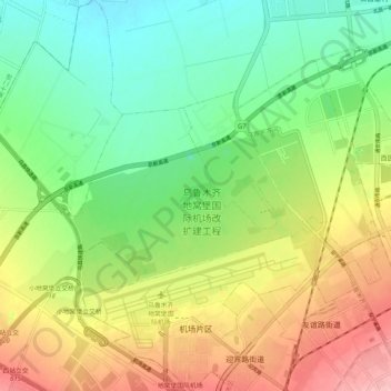
Name: 机场片区 topographic map, elevation, terrain.
Location: 机场片区, 新市区, Ürümqi, Xinjiang, 830000, Chine (43.88534 87.42323 43.96013 87.52029)
Average elevation: 631 m
Minimum elevation: 573 m
Maximum elevation: 716 m
Other topographic maps
Click on a map to view its topography, its elevation and its terrain.