
Kreublach topographic map
Interactive map
Click on the map to display elevation.
About this map
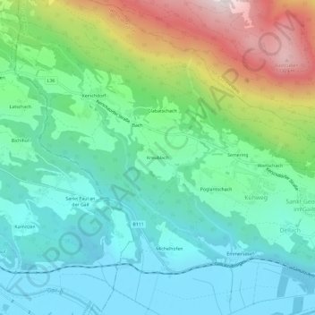
Name: Kreublach topographic map, elevation, terrain.
Average elevation: 793 m
Minimum elevation: 546 m
Maximum elevation: 1,418 m
Other topographic maps
Click on a map to view its topography, its elevation and its terrain.
Semering
Österreich > Kärnten > Bezirk Villach-Land > Nötsch im Gailtal > Kühweg > Semering
Semering, Kühweg, Nötsch im Gailtal, Bezirk Villach-Land, Kärnten, 9612, Österreich
Average elevation: 826 m