
Thank you for supporting this site ❤️
Make a donation
Make a donation
Lake Rukwa topographic map
Click on the map to display elevation.
Thank you for supporting this site ❤️
Make a donation
Make a donation
Lake Rukwa
The alkaline Lake Rukwa lies midway between Lake Tanganyika and Lake Malawi at an elevation of about 800 metres (2,600 ft), in a parallel branch of the rift system. Almost half of the lake lies in Uwanda Game Reserve.
Thank you for supporting this site ❤️
Make a donation
Make a donation
About this map
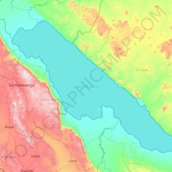
Name: Lake Rukwa topographic map, elevation, terrain.
Location: Lake Rukwa, Songwe Region, Southern Highlands Zone, Tanzania (-8.50863 31.53946 -7.42159 32.93349)
Average elevation: 1,189 m
Minimum elevation: 790 m
Maximum elevation: 2,425 m
Thank you for supporting this site ❤️
Make a donation
Make a donation
Other topographic maps
Click on a map to view its topography, its elevation and its terrain.