
Thank you for supporting this site ❤️
Make a donation
Make a donation
Matebeleng Ha Ntina topographic map
Click on the map to display elevation.
Thank you for supporting this site ❤️
Make a donation
Make a donation
About this map
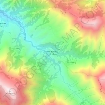
Name: Matebeleng Ha Ntina topographic map, elevation, terrain.
Location: Matebeleng Ha Ntina, Maseru District, Lesotho (-29.79437 27.77704 -29.75437 27.81704)
Average elevation: 2,100 m
Minimum elevation: 1,703 m
Maximum elevation: 2,628 m
Thank you for supporting this site ❤️
Make a donation
Make a donation
Other topographic maps
Click on a map to view its topography, its elevation and its terrain.