
Cloud County topographic map
Interactive map
Click on the map to display elevation.
About this map
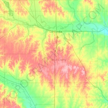
Name: Cloud County topographic map, elevation, terrain.
Location: Cloud County, Kansas, USA (39.30714 -97.93047 39.65458 -97.36818)
Average elevation: 440 m
Minimum elevation: 388 m
Maximum elevation: 517 m
Other topographic maps
Click on a map to view its topography, its elevation and its terrain.
Independence
USA > Kansas > Independence
Independence, Montgomery County, Kansas, 67301, USA
Average elevation: 245 m