
Thank you for supporting this site ❤️
Make a donation
Make a donation
Grotticelle topographic map
Click on the map to display elevation.
Thank you for supporting this site ❤️
Make a donation
Make a donation
About this map
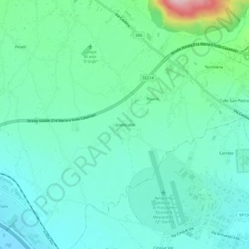
Name: Grotticelle topographic map, elevation, terrain.
Location: Grotticelle, Ferentino, Frosinone, Lazio, 03013, Italia (41.63896 13.26649 41.67896 13.30649)
Average elevation: 203 m
Minimum elevation: 143 m
Maximum elevation: 429 m
Thank you for supporting this site ❤️
Make a donation
Make a donation
Other topographic maps
Click on a map to view its topography, its elevation and its terrain.