
Thank you for supporting this site ❤️
Make a donation
Make a donation
Segero topographic map
Click on the map to display elevation.
Thank you for supporting this site ❤️
Make a donation
Make a donation
About this map
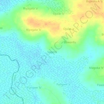
Name: Segero topographic map, elevation, terrain.
Location: Segero, Tororo, Uganda (0.65958 33.88980 0.69958 33.92980)
Average elevation: 1,078 m
Minimum elevation: 1,067 m
Maximum elevation: 1,101 m
Thank you for supporting this site ❤️
Make a donation
Make a donation