
Rendova Island topographic map
Interactive map
Click on the map to display elevation.
About this map
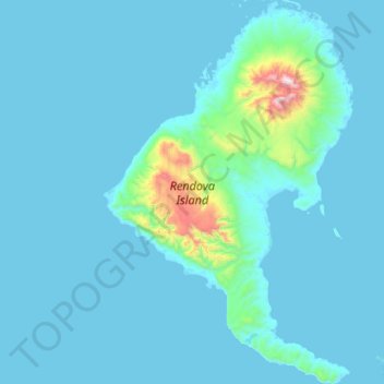
Name: Rendova Island topographic map, elevation, terrain.
Location: Rendova Island, Western Province, Solomon Islands (-8.73072 157.19244 -8.40018 157.40982)
Average elevation: 69 m
Minimum elevation: -1 m
Maximum elevation: 1,021 m