
Thank you for supporting this site ❤️
Make a donation
Make a donation
Toad Suck topographic map
Click on the map to display elevation.
Thank you for supporting this site ❤️
Make a donation
Make a donation
About this map
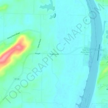
Name: Toad Suck topographic map, elevation, terrain.
Location: Toad Suck, Perry County, Arkansas, United States (35.05564 -92.57988 35.09564 -92.53988)
Average elevation: 93 m
Minimum elevation: 77 m
Maximum elevation: 179 m
Thank you for supporting this site ❤️
Make a donation
Make a donation
Other topographic maps
Click on a map to view its topography, its elevation and its terrain.