
Thank you for supporting this site ❤️
Make a donation
Make a donation
Genthin topographic map
Click on the map to display elevation.
Thank you for supporting this site ❤️
Make a donation
Make a donation
About this map
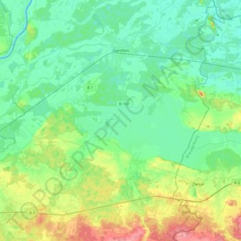
Name: Genthin topographic map, elevation, terrain.
Location: Genthin, Jerichower Land, Саксония-Анхальт, 39307, Германия (52.20515 12.02726 52.45925 12.27315)
Average elevation: 47 m
Minimum elevation: 27 m
Maximum elevation: 103 m
Thank you for supporting this site ❤️
Make a donation
Make a donation
Other topographic maps
Click on a map to view its topography, its elevation and its terrain.