
Făgăraș topographic map
Interactive map
Click on the map to display elevation.
About this map
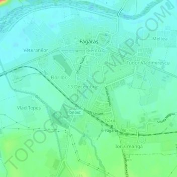
Name: Făgăraș topographic map, elevation, terrain.
Location: Făgăraș, Brașov, 505200, Roumanie (45.82394 24.94862 45.84935 24.99316)
Average elevation: 432 m
Minimum elevation: 419 m
Maximum elevation: 475 m
L’altitude est située entre 424 et 441 mètres.