
Thank you for supporting this site ❤️
Make a donation
Make a donation
Buchanan Dam topographic map
Click on the map to display elevation.
Thank you for supporting this site ❤️
Make a donation
Make a donation
About this map
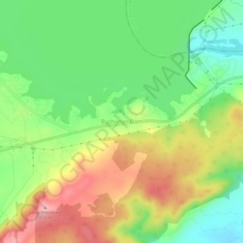
Name: Buchanan Dam topographic map, elevation, terrain.
Location: Buchanan Dam, Llano County, Texas, 78609, United States (30.71990 -98.45114 30.75990 -98.41114)
Average elevation: 327 m
Minimum elevation: 261 m
Maximum elevation: 412 m
Thank you for supporting this site ❤️
Make a donation
Make a donation
Other topographic maps
Click on a map to view its topography, its elevation and its terrain.