
Make a donation
Sahale Mountain topographic map
Click on the map to display elevation.
Make a donation
Sahale Mountain
The North Cascades features some of the most rugged topography in the Cascade Range with craggy peaks and ridges, deep glacial valleys, and granite spires. Geological events occurring many years ago created the diverse topography and drastic elevation changes over the Cascade Range leading to various climate differences.
Make a donation
About this map
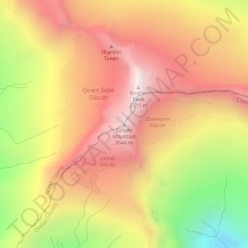
Name: Sahale Mountain topographic map, elevation, terrain.
Location: Sahale Mountain, Skagit County, Washington, United States (48.49136 -121.03844 48.49146 -121.03834)
Average elevation: 2,132 m
Minimum elevation: 1,357 m
Maximum elevation: 2,677 m
Make a donation
Other topographic maps
Click on a map to view its topography, its elevation and its terrain.
Make a donation
Make a donation
Make a donation
Skyline Home Owners Association
United States > Washington > Skagit County > Anacortes
Average elevation: 14 m
Make a donation
Make a donation
Concrete
United States > Washington > Skagit County
Mears Field (3W5), formerly known as Concrete Municipal Airport, is located one mile south of Concrete at an elevation of 267 ft MSL.
Average elevation: 125 m