
Thank you for supporting this site ❤️
Make a donation
Make a donation
Mandeville topographic map
Click on the map to display elevation.
Thank you for supporting this site ❤️
Make a donation
Make a donation
About this map
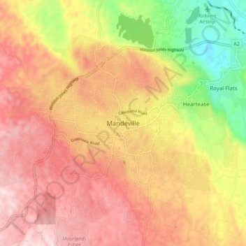
Name: Mandeville topographic map, elevation, terrain.
Location: Mandeville, Manchester, Middlesex County, Jamaica (18.00313 -77.54741 18.08313 -77.46741)
Average elevation: 615 m
Minimum elevation: 358 m
Maximum elevation: 798 m
Thank you for supporting this site ❤️
Make a donation
Make a donation
Other topographic maps
Click on a map to view its topography, its elevation and its terrain.