
Thank you for supporting this site ❤️
Make a donation
Make a donation
Storsand topographic map
Click on the map to display elevation.
Thank you for supporting this site ❤️
Make a donation
Make a donation
About this map
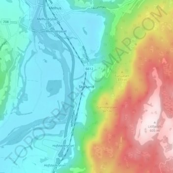
Name: Storsand topographic map, elevation, terrain.
Location: Storsand, Melhus, Трёнделаг, 7224, Норвегия (63.24773 10.27353 63.28773 10.31353)
Average elevation: 185 m
Minimum elevation: 4 m
Maximum elevation: 606 m
Thank you for supporting this site ❤️
Make a donation
Make a donation
Other topographic maps
Click on a map to view its topography, its elevation and its terrain.
Thank you for supporting this site ❤️
Make a donation
Make a donation