
Thank you for supporting this site ❤️
Make a donation
Make a donation
Kibichoi topographic map
Click on the map to display elevation.
Thank you for supporting this site ❤️
Make a donation
Make a donation
About this map
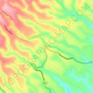
Name: Kibichoi topographic map, elevation, terrain.
Location: Kibichoi, Komothai, Githunguri, Kiambu, Kenya (-1.06658 36.84195 -1.02658 36.88195)
Average elevation: 1,718 m
Minimum elevation: 1,638 m
Maximum elevation: 1,792 m
Thank you for supporting this site ❤️
Make a donation
Make a donation
Other topographic maps
Click on a map to view its topography, its elevation and its terrain.