
Thank you for supporting this site ❤️
Make a donation
Make a donation
Hotunje topographic map
Click on the map to display elevation.
Thank you for supporting this site ❤️
Make a donation
Make a donation
About this map
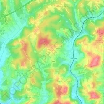
Name: Hotunje topographic map, elevation, terrain.
Location: Hotunje, Šentjur, 3222, Slovenia (46.22969 15.39868 46.26969 15.43868)
Average elevation: 305 m
Minimum elevation: 262 m
Maximum elevation: 363 m
Thank you for supporting this site ❤️
Make a donation
Make a donation