
Xiangtan topographic map
Click on the map to display elevation.
About this map
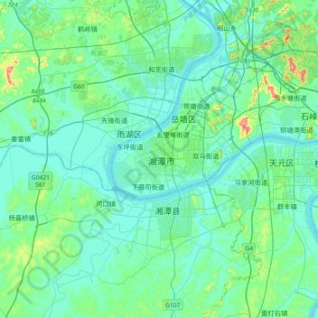
Name: Xiangtan topographic map, elevation, terrain.
Location: Xiangtan, Yuetang District, Xiangtan, Hunan, 411104, China (27.67263 112.77872 27.99263 113.09872)
Average elevation: 64 m
Minimum elevation: 24 m
Maximum elevation: 303 m